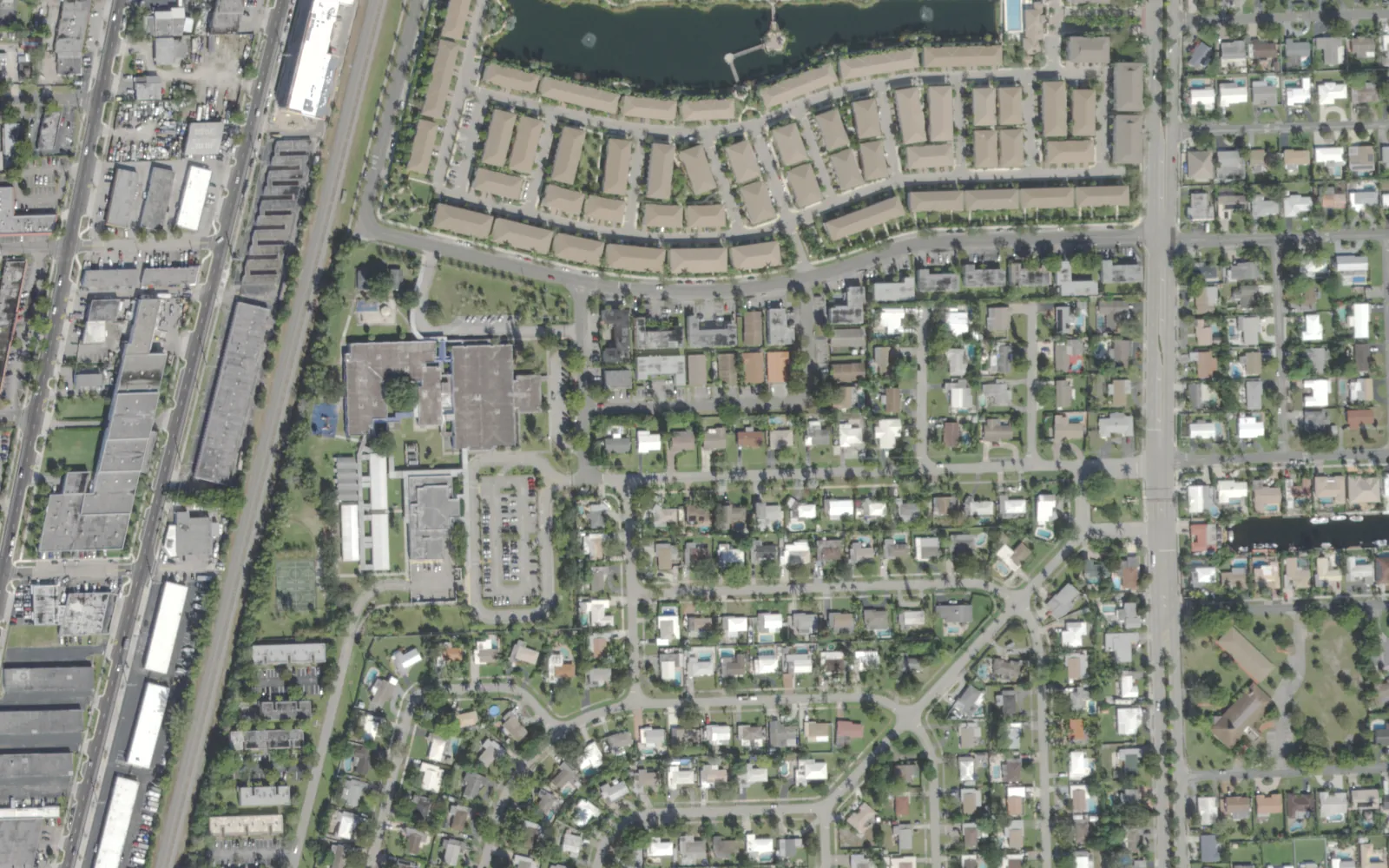
Lyons Park, about 291 acres between Dixie Highway and Cypress Road in ZIP 33060, has Cypress Elementary inside it and a Publix on Cypress Road.
Last checked Oct. 10, 2026. Sources: the City of Pompano Beach neighborhoods map (PDF), the Broward County Property Appraiser’s neighborhood layer, Broward County’s address points, school boundaries and parks layer, the Florida Department of Education’s 2026 school grades, Zillow Research, Broward County Transit and OpenStreetMap.
Lyons Park is a residential strip in south-central Pompano Beach, south of Atlantic Boulevard, with the rail line along Dixie Highway on its west side and Cypress Road on its east. It has its own elementary school and a supermarket, and it is close to both downtown and the interstate. City Hall is about 1.3 miles away by road.
What this means for you
- Zoned high school: Blanche Ely High for every address, a C school in Florida’s 2026 grades. Check yours with the district’s Find My School tool.
- Home value: $429,678 in ZIP 33060 in August 2026, according to the Zillow Home Value Index.
- Nearest interstate exit: I-95 exit 36, Atlantic Boulevard, about 1.9 miles by road.
Part of our Pompano Beach neighborhoods guide.
Where it is
The city’s neighborhoods map, drawn by the Development Services Department, labels the area Lyons Park. Its edges:
- West: Dixie Highway and the FEC railway, with South Dixie and John Knox Village beyond
- East: Cypress Road, with Garden Isles across it
- North: just south of Atlantic Boulevard, with Avondale and the Civic Campus to the north
- South: Boulevard Park, toward McNab Road
The Broward County Property Appraiser’s Lyons Park outline covers about 291 acres. Broward County’s address data has about 910 street addresses in it, all in ZIP code 33060.
Schools
How the area’s addresses fall in Broward County’s 2025-26 school boundary layers, updated March 2026, with each school’s 2026 grade from the Florida Department of Education. The percentage is the share of possible points the school earned.
| Level | School | Share of addresses | 2026 grade |
|---|---|---|---|
| Elementary | Cypress Elementary, 851 SW 3rd Ave. (report card) | 76% | A (66%) |
| Elementary | McNab Elementary, 1350 SE 9th Ave. (report card) | 24% | A (68%) |
| Middle | Pompano Beach Middle, 310 NE 6th St. (report card) | 100% | B (63%) |
| High | Blanche Ely High, 1201 NW 6th Ave. (report card) | 100% | C (57%) |
Cypress Elementary is inside the area and also earned an A in 2025. McNab Elementary serves the south end of the area, the streets around SW 13th and SW 14th streets. Blanche Ely High earned an A in 2025 and reported a 95% graduation rate for 2024-25. Confirm an address with the district’s Find My School tool. More in our schools guide.
Home values
The typical home value in ZIP 33060 was $429,678 in August 2026, down 1.3% from $435,223 in August 2025, according to the Zillow Home Value Index. The index is a modeled typical value for the middle third of homes, single-family homes and condos together, not a sale price. It covers the whole ZIP code, which also includes Old Pompano and much of central and southern Pompano Beach, so it is not a Lyons Park-only figure. The citywide Pompano Beach figure was $351,953, down 1.9% on the year. More in our home prices guide.
Parks and trails
Broward County’s parks layer shows no park inside the outline. Nearby:
- Norwood Pines Park, 570 S. Cypress Road, a city park of about 5 acres in the county’s parks layer, about a seventh of a mile east across Cypress Road.
- Founders Park, 306 NE 3rd St., about a third of a mile north in Old Pompano.
- E. Pat Larkins Community Center, 520 Martin Luther King Jr. Blvd., about a third of a mile north.
More in our parks and trails guide.
Getting around
- Interstate: I-95 exit 36, Atlantic Boulevard, about 1.9 miles by road from the middle of the area, and exit 33, Cypress Creek Road, about 2.9 miles. Florida’s Turnpike exit 66, Atlantic Boulevard, is about 5.4 miles; the Turnpike is a toll road.
- City Hall: about 1.3 miles to 100 W. Atlantic Blvd.
- Airport: about 14.6 miles to Fort Lauderdale-Hollywood International Airport, the shortest trip of any area in this guide.
- These are distances measured on the OpenStreetMap road network with the OSRM routing engine, not drive times.
- Bus: In Broward County Transit’s published schedule data for summer 2026, Route 20 has nine stops on Cypress Road inside the area, from SW 2nd Street to SE 14th Street. Route 50 (Dixie Highway) and Route 60 (Andrews Avenue) stop on Dixie Highway along the west side. Check current times on BCT’s website or at 954-357-8400.
More in our getting around guide.
Groceries and everyday stores
From OpenStreetMap:
- Publix, 411 S. Cypress Road, inside the area
- Pompano Supermarket, 11 NE 3rd St., and Saxon & Wall Supermarket, 321 NW 3rd Ave., both about a third of a mile north
The Pompano Beach Branch Library, 50 E. Atlantic Blvd., is about a tenth of a mile north.
How we drew this area
The City of Pompano Beach’s neighborhoods map names Lyons Park and draws its edges. We used the Broward County Property Appraiser’s Lyons Park outline for the acreage and counted every Broward County address point inside it, matched to the county’s 2025-26 school boundary layers on Oct. 10, 2026. Store and library locations are © OpenStreetMap contributors.
Frequently asked questions
What schools serve Lyons Park in Pompano Beach?
In Broward County’s 2025-26 school boundary data, every Lyons Park address is zoned for Pompano Beach Middle and Blanche Ely High. For elementary school, 76% of addresses are zoned for Cypress Elementary, which is inside the area, and 24%, at the south end, for McNab Elementary. Both elementary schools earned an A in Florida’s 2026 grades.
What ZIP code is Lyons Park in?
- Zillow put the typical home value in that ZIP code at $429,678 in August 2026, down 1.3% on the year. The figure covers the whole ZIP code, which also includes Old Pompano and much of central and southern Pompano Beach.
Is Lyons Park a good place to live?
Here are the facts. Lyons Park covers about 291 acres with about 910 street addresses, an A-rated elementary school in Florida’s 2026 grades and a supermarket inside it. It is about 1.3 miles by road from City Hall and 1.9 miles from I-95 exit 36, and it is the closest area in this guide to Fort Lauderdale-Hollywood International Airport by road.
Where is Lyons Park in Pompano Beach?
South of Atlantic Boulevard between Dixie Highway and Cypress Road, according to the city’s neighborhoods map. Garden Isles is to the east across Cypress Road, and Boulevard Park is to the south.
Have your say