Downtown and Old Pompano, about 675 acres north of Atlantic Boulevard in ZIP 33060, take in City Hall, Kester Park and two public schools.
Last checked Oct. 10, 2026. Sources: the City of Pompano Beach neighborhoods map (PDF), the Broward County Property Appraiser’s neighborhood layer, Broward County’s address points, school boundaries and parks layer, the Florida Department of Education’s 2026 school grades, Zillow Research, Broward County Transit and OpenStreetMap.
Downtown and Old Pompano are the city’s original center, north of Atlantic Boulevard between Dixie Highway and Federal Highway. The city’s neighborhoods map draws three pieces here: Old Pompano, the residential streets up to NE 10th Street; Downtown, around Atlantic Boulevard and Dixie Highway; and the Civic Campus around City Hall at 100 W. Atlantic Blvd. This guide treats them as one area. City Hall is about 1 mile by road from the middle of it.
What this means for you
- Zoned high school: Blanche Ely High for every address, a C school in Florida’s 2026 grades. Check yours with the district’s Find My School tool.
- Home value: $429,678 in ZIP 33060 in August 2026, according to the Zillow Home Value Index.
- Nearest interstate exit: I-95 exit 36, Atlantic Boulevard, about 1.6 miles by road.
Part of our Pompano Beach neighborhoods guide.
Where it is
The city’s neighborhoods map, drawn by the Development Services Department, shows these edges:
- South: Atlantic Boulevard, with Snug Harbor and Avondale across it
- North: NE 10th Street, with Pompano Airpark across it
- East: Federal Highway (U.S. 1), with Harbor Village beyond
- West: around Dixie Highway and the FEC railway, with Blanche Ely to the northwest
NE 2nd Street and NE 4th Street run east to west through Old Pompano. The Broward County Property Appraiser’s three outlines, Old Pompano, Downtown Pompano Beach and Civic Campus, cover about 675 acres together. Broward County’s address data has about 915 street addresses in them, all in ZIP code 33060. Our history and landmarks guide covers the older buildings.
Schools
How the area’s addresses fall in Broward County’s 2025-26 school boundary layers, updated March 2026, with each school’s 2026 grade from the Florida Department of Education. The percentage is the share of possible points the school earned.
| Level | School | Share of addresses | 2026 grade |
|---|---|---|---|
| Elementary | Pompano Beach Elementary, 700 NE 13th Ave. (report card) | 88% | A (66%) |
| Elementary | McNab Elementary, 1350 SE 9th Ave. (report card) | 12% | A (68%) |
| Middle | Pompano Beach Middle, 310 NE 6th St. (report card) | 100% | B (63%) |
| High | Blanche Ely High, 1201 NW 6th Ave. (report card) | 100% | C (57%) |
Pompano Beach Elementary and Pompano Beach Middle are both inside the area. McNab Elementary serves the strip of streets just south of Atlantic Boulevard that the county’s outlines include, SE 1st through SE 3rd streets. Pompano Beach Elementary moved up from a B in 2025; Blanche Ely High earned an A in 2025 and reported a 95% graduation rate for 2024-25.
Pompano Beach High, 600 NE 13th Ave., is also inside the area and earned an A with 80% of possible points, but no address in the city is zoned for it in the district’s boundary data. Confirm an address with the district’s Find My School tool. More in our schools guide.
Home values
The typical home value in ZIP 33060 was $429,678 in August 2026, down 1.3% from $435,223 in August 2025, according to the Zillow Home Value Index. The index is a modeled typical value for the middle third of homes, single-family homes and condos together, not a sale price. It covers the whole ZIP code, which also includes Lyons Park and much of central and southern Pompano Beach. The citywide Pompano Beach figure was $351,953, down 1.9% on the year. More in our home prices guide.
Parks and trails
From the city’s park list:
- Pompano Beach Community Park, 1660 NE 10th St., 71 acres on the area’s north edge, with the Emma Lou Olson Civic Center, a walking, jogging and biking track, 12 pickleball courts, basketball, baseball, handball, volleyball, a playground and picnic areas.
- Kester Park, 702 NE 6th St., 8.4 acres with a walking and jogging track, a playground, baseball fields, restrooms and rentable pavilions.
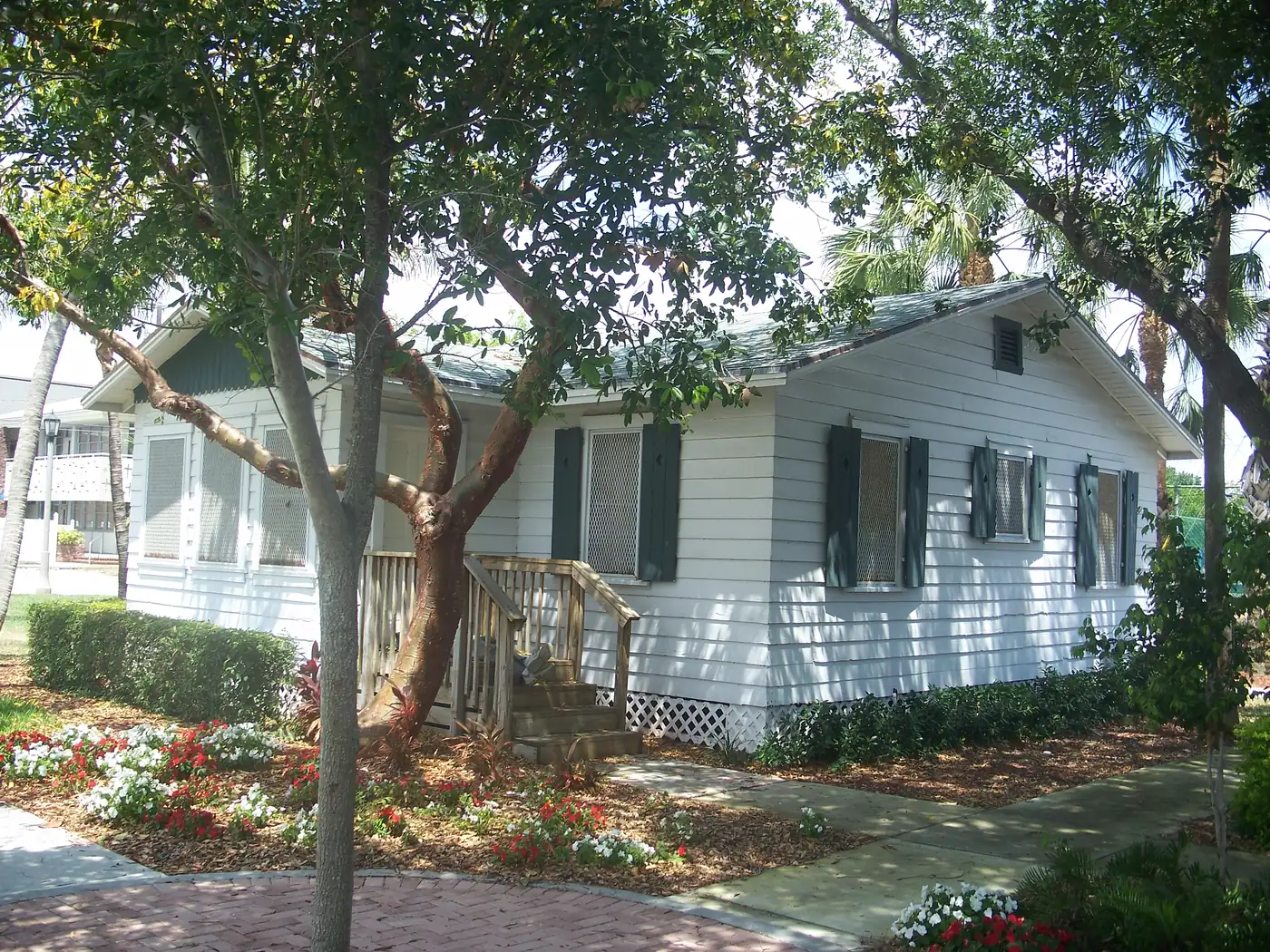
- Founders Park, 306 NE 3rd St., home to the Kester Cottages shown above.
- Air Park Jogging Track, 1001 NE 10th St., on the area’s north edge, 8.4 acres with a walking, jogging and bike path; dogs are allowed.
The Pompano Beach Branch Library, 50 E. Atlantic Blvd., is inside the area, according to OpenStreetMap. More in our parks and trails guide.
Getting around
- Interstate: I-95 exit 36, Atlantic Boulevard, about 1.6 miles by road from the middle of the area. Florida’s Turnpike exit 66, also Atlantic Boulevard, is about 5.5 miles; the Turnpike is a toll road.
- City Hall: about 1 mile to 100 W. Atlantic Blvd.
- Airport: about 16 miles to Fort Lauderdale-Hollywood International Airport.
- These are distances measured on the OpenStreetMap road network with the OSRM routing engine, not drive times.
- Bus: In Broward County Transit’s published schedule data for summer 2026, Route 42 (Atlantic Boulevard) has 11 stops inside the area, Route 10 (Federal Highway) and Route 50 (Dixie Highway) four each, Route 20 three and Route 60 one. BCT’s Northeast Transit Center, at Martin Luther King Jr. Boulevard and Dixie Highway, is just outside the northwest corner. Check current times on BCT’s website or at 954-357-8400.
More in our getting around guide.
Groceries and everyday stores
From OpenStreetMap:
- Pompano Supermarket, 11 NE 3rd St., inside the area
- Aldi, 960 N. Federal Highway, about a tenth of a mile outside the area
- Saxon & Wall Supermarket, 321 NW 3rd Ave., about a fifth of a mile outside
- Publix, 2511 E. Atlantic Blvd., about three-tenths of a mile outside
- CVS Pharmacy, at Atlantic Boulevard and Federal Highway, just outside the area
How we drew this area
The City of Pompano Beach’s neighborhoods map names Old Pompano, Downtown and the Civic Campus and draws their edges. We joined the three Broward County Property Appraiser outlines with those names for the acreage and counted every Broward County address point inside them, matched to the county’s 2025-26 school boundary layers on Oct. 10, 2026. Library and store locations are © OpenStreetMap contributors.
Frequently asked questions
What schools serve Downtown and Old Pompano?
In Broward County’s 2025-26 school boundary data, every address in the area is zoned for Pompano Beach Middle and Blanche Ely High. For elementary school, 88% of addresses are zoned for Pompano Beach Elementary and 12%, on the streets just south of Atlantic Boulevard, for McNab Elementary. Both elementary schools earned an A in Florida’s 2026 grades.
What ZIP code is Old Pompano in?
- Zillow put the typical home value in that ZIP code at $429,678 in August 2026, down 1.3% on the year. The figure covers the whole ZIP code, which also includes Lyons Park and much of central and southern Pompano Beach.
Is Old Pompano a good place to live?
Here are the facts. Downtown and Old Pompano cover about 675 acres with about 915 street addresses, City Hall, a branch library, three city parks and two public schools inside. It is about 1.6 miles by road from I-95 exit 36, and five Broward County Transit routes stop in it.
Is Pompano Beach High the zoned high school for Old Pompano?
No. Pompano Beach High is at 600 NE 13th Ave., inside the area, but no address in the city is zoned for it in Broward County’s 2025-26 school boundary data. Every Downtown and Old Pompano address is zoned for Blanche Ely High.
Have your say